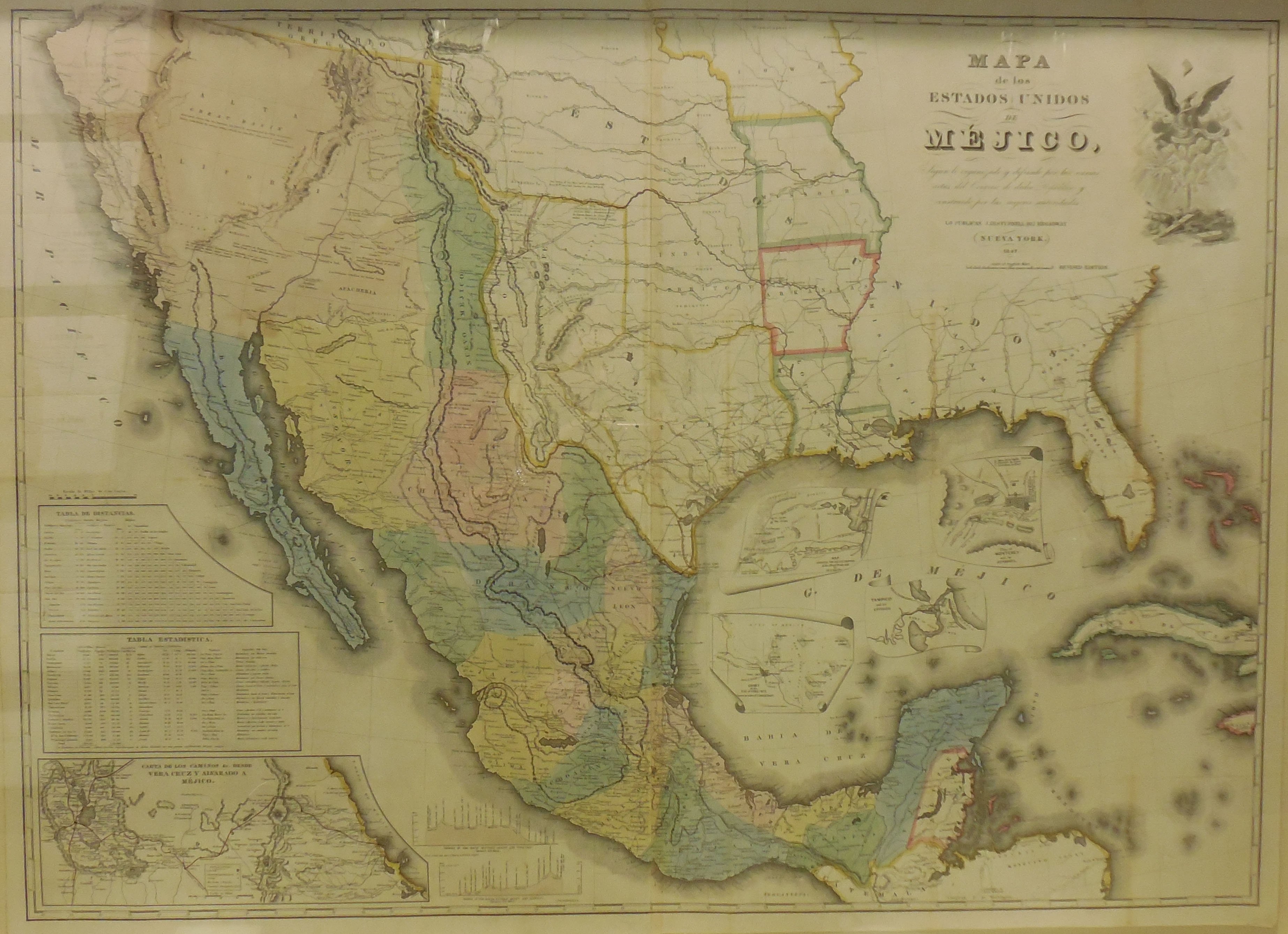
“Mapa de los Estados Unidos de Mejico,” John Disturnell (American, 1801-1877), reproduced in New York in 1847, ink and paper, 2015.15.23.
This originally Mexican made map shows the rapid change of land ownership in the southeastern now-United states during the Polk administration. James. K. Polk was elected in 1844 and immediately implemented his expansionist “manifest destiny” agenda. Polk happily annexed the state of Texas in 1844 and signed a deal with the British in 1846 to gain the Oregon territory. Both of these cessions can be seen on the map. One year before this map was made, Mexican Calvary attacked U.S. troops that aggressively crossed the Rio Grande starting the Mexican American war. The then politically fractured and fledgling Mexican government stood little chance against the U.S. military and surrendered in 1848. The Mexican cession of 1848 marked Polk’s greatest land grab gaining areas of the modern states of California, Utah, Nevada, Arizona and New Mexico. On this pre-treaty map, the small green area of Nuevo Mejico and the large tan area of Alta California were all enveloped by the United States.
-
- “Mapa de los Estados Unidos de Mejico,” John Disturnell (American, 1801-1877), reproduced in New York in 1847, ink and paper, 2015.15.23.