Dates: January 15, 2011–May 22, 2011
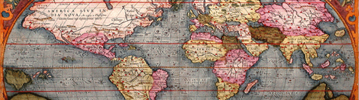
Mapping the New World
explores the history of map making.
The first is an explanation of some of the basic principles of map making and map use—longitude, latitude, and projections. The second and principal focus of the exhibition is a selection of twenty-nine original maps that date from 1493 to 1847. Starting with a Ptolemaic map of the world as conceived in the Middle Ages, the maps trace the increasing geographical knowledge of the New World, finally focusing on the southeastern United States and Tennessee. Nineteen of the early maps come from the renowned collection of W. Graham Arader III in New York; ten come from the Special Collections at Hodges Library. Included with the early maps are seven early navigational instruments on loan from the Smithsonian Institution, National Museum of American History, and the Kenneth E. Behring Center.
The exhibition ends with a third section that explores today’s geospatial revolution employing satellites, GIS, and GPS. Garmin, the manufacturer of navigation and communication devices, has loaned nine instruments that reflect some of the amazing options that are available. To illustrate the geospatial revolution, two short DVDs from Penn State Public Broadcasting can be viewed by the visitor.